Winter Storm Hernando Loosens Its Grip, but Northeast Faces Lingering Hazards
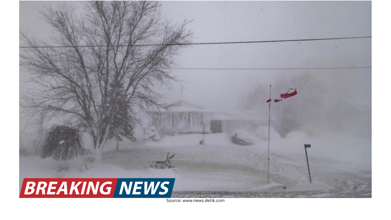
Winter Storm Hernando began easing its grip on parts of the Northeast late Monday, but the storm’s most disruptive impacts were far from over. While the heaviest snow was expected to wind down in many areas, powerful winds continued to whip across the region overnight, raising the risk of whiteout conditions as snow drifted back onto roads and sidewalks. Thousands of residents were also still dealing with power outages, and officials warned that the ripple effects from days of cancellations and closures could keep communities in a state of disruption into Tuesday.
The storm, described as a “bomb cyclone,” was linked to at least two deaths, and emergency declarations were issued by governors in seven states. Winter weather alerts stretched across a broad swath of the Northeast and Mid-Atlantic, reflecting a system that affected not only local roads and neighborhoods, but also national travel and logistics.
What changed Monday night—and what didn’t
By Monday evening, meteorologists noted that the most intense snowfall associated with Hernando had largely finished. However, the storm’s wind field remained a major problem. Even where snowfall rates slowed, strong gusts were capable of producing near-zero visibility in open areas as loose snow was blown into the air and pushed into drifts. That combination—lingering wind plus fresh snow on the ground—meant that conditions could remain dangerous even after the last flakes fell.
Some blizzard warnings along the coastal Northeast were set to expire Monday evening, including in major cities such as New York and Portland, Maine, as snowfall began to ease. Boston, however, was among the places that could continue to see blizzard conditions into early Tuesday, particularly in areas more exposed to wind.
Coastal flooding concerns also shifted. The peak threat had already occurred during the day Monday, but the early Tuesday morning high tide still had the potential to push some monitoring sites back into action stage or minor flood stage, according to the National Weather Prediction Service.
Officials urge caution as travel remains difficult
Even as warnings and bans evolved, public safety messaging remained consistent: avoid travel if possible. Officials continued to recommend staying off the roads, emphasizing that if travel was unavoidable, people should allow extra time and drive with extreme care.
One reason for the caution was the expected transition from snow-covered roads to a more treacherous mix of partial melting and refreezing. In New York City, blizzard warnings expired, but forecasters and officials stressed the city would need time to dig out. Travel was expected to remain difficult for days as temperatures and road treatments interacted with compacted snow, leading to icy conditions.
In New York City, officials said every street had been plowed at least once. Still, with snow continuing to fall at times and winds blowing it back onto cleared surfaces, some streets could appear untouched. The city’s sanitation crews continued repeated passes to keep roads as clear as possible. A citywide travel ban was lifted, but drivers were warned that roads remained slick.
Power outages: improving in some areas, still severe in others
One of the most widespread impacts of Hernando was the loss of electricity. Power outages began dropping for the first time since the storm started, but the numbers remained high across multiple states.
Massachusetts was the hardest hit. More than 282,000 customers were without power at one point, accounting for roughly half of all outages linked to the storm. Outages across Massachusetts were also reported as nearing 290,000. New Jersey followed with about 93,000 outages.
On a broader scale, more than 650,000 customers were reported without power nationwide. In addition to Massachusetts and New Jersey, Delaware, Rhode Island and Maryland were among the states with significant impacts. With heavy snow still falling in some locations and roads nearly impassable in parts of this densely populated corridor, officials warned restoration could take time—especially in areas where downed trees and damaged utility infrastructure complicated access.
Nantucket was highlighted as a place where outages could be long lasting. Footage from local media showed power poles covered in snow, snapped and lying by the roadside—damage that can require extensive repairs before electricity can be restored.
Snow totals: from major cities to record-setting reports
Hernando delivered substantial snowfall across the region, with some locations reporting remarkable totals. Boston had seen around 15 inches of snow during the storm. In New York City’s Central Park, totals were reported at just over 15 inches—its heaviest snowstorm in more than five years, since a 17.4-inch event from late January to early February 2021.
In and around the New York City area, officials and meteorologists noted that totals would need to be carefully reviewed in some places because drifting can inflate measurements. Islip was cited as a location that may have approached a record, though totals would need reexamination to determine how much was snowfall versus drift.
Rhode Island saw some of the most striking numbers. Providence’s T.F. Green Airport officially reported a two-day snowfall total of 32.8 inches, making it the snowiest two-day period on record there and surpassing the previous record of 28.6 inches from the “Blizzard of ’78.” The airport also reported 30.4 inches for a single day, breaking the previous one-day record of 19 inches that ended on January 8, 1996.
Elsewhere, Freehold Township, New Jersey, reported 24.2 inches on the ground officially from Hernando. In that same area of Monmouth County, about 9% of customers were without power at one point, reflecting the storm’s combined impact of heavy snow and service disruptions.
Why the snow hit so hard: stalled bands and intense snowfall rates
In major winter storms, total accumulation is only part of the story. How quickly snow falls can determine whether roads become impassable and whether plows can keep up. During Hernando, snowfall rates were reported at 1 inch per hour at LaGuardia Airport and 2 inches per hour at JFK International Airport. Providence was reported to have picked up nearly 14 inches in just six hours. The National Weather Service office in Upton, Long Island, reported a snowfall rate of 3 inches per hour earlier in the storm.
Meteorologists also pointed to the behavior of the storm’s snowbands. The most prolific snowfalls outside higher elevations often occur when the most intense bands stall over the same area for hours. That is essentially what was observed along the Eastern Seaboard from Delaware to southern New England, where radar imagery showed heavy bands that moved very little over a multi-hour period.
Blizzard conditions: more than just heavy snow
As blizzard warnings remained in effect for some communities even after snowfall began to taper, forecasters emphasized a key point: blizzard conditions are defined by more than accumulation. The National Weather Service definition requires a combination of strong winds and reduced visibility, and those conditions must occur simultaneously for a blizzard to be officially ongoing.
Importantly, a blizzard can occur even without new snow falling. If winds remain strong enough to blow existing snow and reduce visibility, blizzard criteria can still be met. That detail mattered during Hernando, when wind-driven snow continued to create near-whiteout conditions in exposed areas even as the heaviest snowfall shifted away.
Bomb cyclone explained: hurricane-like look, different engine
Satellite imagery showed Hernando swirling off the East Coast in a way that can resemble a hurricane. The storm brought powerful winds and heavy precipitation, and its structure appeared dramatic on satellite views. But meteorologists cautioned that the similarities are largely visual.
Unlike hurricanes, which draw energy from warm tropical waters and have a warm core, bomb cyclones form when a low-pressure system strengthens rapidly—often at higher latitudes—when cold air meets warmer ocean waters. Because cold air is involved, these systems maintain a cold core.
Hernando met and exceeded the criteria for rapid intensification. With a reported central pressure drop of about 40 millibars in 12 hours, the storm surpassed the threshold required for “bomb cyclone” status and achieved the requirement in roughly nine hours. Meteorologists noted that its central pressure was similar to that of a Category 2 hurricane, even though its structure and energy source were different.
Roads, rescues and public safety: conditions described as life-threatening
Across multiple states, officials described travel conditions in urgent terms. In Massachusetts, Gov. Maura Healey issued an immediate ban on all non-essential motor vehicle travel in the southern coast of the state. A 40 mph speed limit was also put in place on the Massachusetts Turnpike. Authorities warned that visibility was at or near zero in some areas, plows were struggling to keep up, and ongoing rescue operations had been suspended.
In Maryland, state police reported a heavy workload: more than 1,190 calls for service and responses to nearly 343 crashes as snow made roads slick. About 4 inches fell in Baltimore, with parts of Baltimore County close to 5 inches, according to the National Weather Service. Nearly 30% of calls came from Maryland’s Eastern Shore, where a Blizzard Warning remained in effect through Monday evening due to strong wind gusts.
The storm was also associated with fatal consequences. In Calvert County, Maryland, sheriff’s deputies responded to a serious crash Sunday afternoon in which two passengers were found dead and one person was in critical condition. Early findings indicated a tree, weighed down after up to five inches of snow fell in the area, toppled into the roadway and struck the vehicle.
Schools and city services: closures, reopenings and the work of digging out
Hernando forced dozens of school districts to close across the Northeast, including some of the nation’s largest systems. New York City and Boston were among the major districts affected. New York City’s closure was notable because it represented the city’s first true, traditional snow day without remote learning since before the pandemic in 2019.
New York City public schools were set to reopen Tuesday, the mayor announced. The day off required a waiver, and officials noted that with the midwinter break ending, many students did not have their devices at home. The storm also stranded some families and teachers during vacation travel amid hundreds of flight cancellations.
City services shifted into high gear. In New York, snow removal involved more than plows. The city had 575 emergency snow shovelers working overnight, clearing 1,500 crosswalks, 400 fire hydrants and 900 bus stops. The city hires emergency shovelers during major storms, with pay starting at $19.14 an hour and rising to $28.71 an hour after the first 40 hours worked in a week.
In Boston, police prepared to navigate deep snow and disappearing streets by deploying All-Terrain Vehicles. Across the region, images showed buried cars, snow-choked sidewalks and vehicles stuck in near-whiteout conditions—visual reminders that the cleanup would extend beyond the end of the snowfall.
Air travel disruption spreads far beyond the storm zone
The storm’s effects were not confined to the Northeast. Flight cancellations cascaded across the country, affecting travelers well outside the snow. In Salt Lake City, more than 40 flights were canceled because of Hernando, even though the local forecast there was sunny with highs in the 50s—an example of how aircraft positioning and network schedules can be disrupted by severe weather in a major corridor.
Nationwide, more than 9,900 flights were canceled since the storm began, with hundreds more already canceled for the following day. Another update put the total above 10,000 cancellations from yesterday through tomorrow in the U.S., including more than 5,300 flights in a single day and about 1,300 already canceled for tomorrow. Travelers with plans into or out of the Northeast were urged to check with airlines frequently as conditions and schedules changed.
Heavy, wet snow adds another layer of risk
Beyond the hazards of driving and power outages, the storm’s snow type created additional concerns. With temperatures hovering around or just below freezing, the air can hold more moisture, leading to heavier, wetter snow. That kind of snow is sometimes nicknamed “heart-attack snow” because shoveling it can put significant strain on the body.
In Massachusetts, heavy snow was also blamed for downed trees that created hazards on roadways and worsened travel conditions. In Pennsylvania, images showed tree damage in King of Prussia, illustrating how the combination of weighty snow and gusty winds can stress branches and power lines.
What to watch heading into Tuesday
As Hernando pulled away from the coast, the region’s focus shifted toward lingering wind, the threat of drifting snow, and the slow work of restoring power and clearing streets. Some areas were still expected to see additional snowfall on top of what had already fallen, and forecasters warned that more was in the forecast for parts of the Northeast after Monday.
For many communities, Tuesday would be less about the storm’s peak and more about the aftermath: icy roads from refreezing, blocked sidewalks, delayed reopenings, and ongoing disruptions to travel and daily routines. Officials continued to stress situational awareness—monitoring local announcements, avoiding unnecessary trips, and taking precautions in homes where power remained out during frigid conditions.
- Strong winds can keep visibility low even after snowfall ends due to drifting.
- Road conditions may worsen as partial melting refreezes into ice.
- Power restoration may take time where trees and damaged poles limit access.
- Coastal flooding concerns can re-emerge around high tide even after the peak surge passes.
- Flight cancellations and delays can persist nationwide as airlines reset schedules and equipment.
Winter Storm Hernando may have begun to loosen its grip by Monday night, but the storm’s footprint—measured in snow totals, outages, closures and travel disruption—was still shaping daily life across the Northeast. For residents in the hardest-hit areas, the next phase was the long process of digging out, staying safe in lingering hazardous conditions, and waiting for essential services to fully return.