Winter Storm Hernando Intensifies Into a Bomb Cyclone, Bringing Blizzard Warnings and Major Disruptions Along the East Coast
A fast-strengthening nor’easter with blizzard impacts
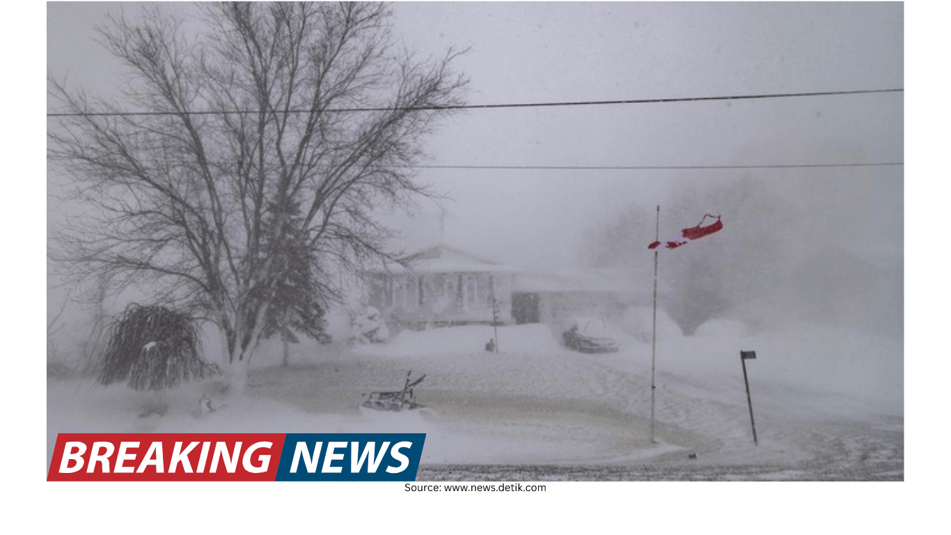
Winter Storm Hernando is unfolding as a powerful nor’easter expected to intensify into a “bomb cyclone” into Monday, a setup that can quickly escalate impacts along the Interstate 95 corridor and coastal New England. Forecasts call for blizzard conditions, heavy snow and damaging winds from the mid-Atlantic to New England, with the most disruptive period extending through Monday as the storm strengthens offshore.
Blizzard warnings have been issued across a wide stretch of the East Coast, from Virginia to New Hampshire, including all five boroughs of New York City. The combination of heavy snow and strong wind is expected to sharply reduce visibility, create drifting and lead to rapidly deteriorating road conditions.
Officials and forecasters have repeatedly urged people in the warned areas to avoid travel. The reason is straightforward: as snowfall rates increase and temperatures drop, roads can become snow-covered quickly, and wind-driven snow can make it difficult to see hazards ahead. With the storm expected to persist into Monday, disruptions to daily life are anticipated to be widespread.
Where snow is already piling up
Snow has been building in parts of the region as the storm ramps up. On Long Island, totals have reached 8 inches, and plow operations are expected to continue for days as crews work through accumulating snow and drifting. Elsewhere, early storm totals have included 6.1 inches near Freehold Township, New Jersey, and around 6 inches near Wintergreen, Virginia.
Even locations that started with lighter snow were expected to see conditions change quickly. In New York City, only light snowfall of up to a half-inch had been reported earlier, but heavier bands were approaching from the south. Forecasts indicated that snowfall rates could reach up to an inch per hour through the evening, and with temperatures falling, roads were expected to become covered rapidly.
In New Jersey, heavier snow was reported in places like Fort Lee as evening approached. In Maryland, the storm’s reach was underscored by images of a nor’easter dumping snow in the state, while the broader forecast continued to point toward a prolonged and potentially historic blizzard in the New York City area.
New York City: travel ban, closures and preparation
New York City has moved toward strict measures as conditions worsen. A travel ban was set to go into effect at 9 p.m., closing roads and bridges to non-essential traffic. The timing reflects how quickly conditions can deteriorate once heavier snow bands arrive and wind increases.
Closures and cancellations began rolling in ahead of the worst conditions. Broadway performances scheduled for 6 p.m. were canceled, and the city announced public schools would be closed on Monday. City sanitation crews were also shown preparing equipment, outfitting garbage trucks with tire chains and snow plows in advance of the storm.
At the same time, residents were seen preparing in familiar ways: lining up for groceries early, and picking up last-minute essentials such as rock salt, snowblower fuel and shovels. With forecasts calling for significant totals—up to 20 inches in New York City in the latest National Weather Service snowfall forecast—many people aimed to be ready for at least a day of limited mobility.
New York has also promoted a practical staffing approach for cleanup: offering part-time jobs paying $19 an hour to help shovel snow. The idea is to add manpower so the city can recover more quickly once the heaviest snow and wind move through.
States of emergency and public service changes
As the storm expanded its footprint, multiple states declared emergencies. Maryland is under a state of emergency, joining New York, New Jersey, Delaware, Massachusetts, Connecticut and Rhode Island. Maryland’s state offices were set to be closed the following day, reflecting expectations for dangerous travel and operational disruptions.
In Massachusetts, Gov. Maura Healey declared a state of emergency that included the activation of up to 200 Massachusetts National Guard members to support storm response operations. Such steps are typically taken to help with tasks ranging from transportation support to emergency response logistics during periods of heavy snow and damaging wind.
Public transportation systems also moved toward shutdowns. In New Jersey, buses, light rail and Access Link were scheduled to be suspended at 6 p.m., with rail service expected to run into the evening but with the possibility of later suspension. These decisions are commonly made when visibility drops, roads become unsafe, and crews need to focus on keeping critical routes open for emergency operations.
Air travel disruptions: cancellations and cascading delays
Air travel has been heavily affected, and the disruption is not limited to one airport. Nearly 1,000 flights into and out of New York’s John F. Kennedy International Airport were canceled for the next day, on top of 724 flights canceled there earlier. Across the Eastern Seaboard—from Washington, D.C., and Baltimore up to Boston—cancellations for the two-day period approached 8,000.
Delays were also mounting nationwide. More than 15,000 delayed flights had already been reported, with expectations that the number would continue rising as storm impacts create gridlock across airport networks. Even travelers who were not flying into the hardest-hit areas could feel the effects as aircraft and crews are repositioned or held in place.
Specific airport impacts underscored the scale of the shutdown. New York City led with more than 60% of flights into JFK and LaGuardia already canceled for the day at one point, while Boston Logan International, Philadelphia International and Ronald Reagan National in Washington, D.C., also recorded hundreds of cancellations. Travelers were advised to check with airlines before heading to the airport and to look for rebooking options or vouchers when available.
Power outages rise as wind increases
As snow piles up and winds strengthen, the risk of power outages increases rapidly—especially in areas where wet, heavy snow loads trees and lines while gusts push them over. Outages in the Northeast surpassed 30,000 customers at one point, and earlier in the event more than 12,000 customers were already without power as winds picked up.
Forecasters warned that the final outage totals could be much higher, potentially reaching into the hundreds of thousands of homes and businesses. That possibility is tied to the wind forecast and the likelihood of downed trees and power lines as the storm’s strongest bands and gusts move through.
Because outages can occur quickly and last longer than expected during major snow events, residents were directed toward practical safety guidance for staying warm and avoiding hazards such as carbon monoxide poisoning.
Wind forecasts: from strong gusts to dangerous peaks
Wind is a major part of the Hernando forecast, and it is central to whether conditions meet blizzard criteria. In the New York City area, gusts were forecast to reach 55 mph, with heavy snow continuing through the overnight hours and into Monday. Blizzard warnings were expected to remain in place until Monday night in some areas.
In Boston, the wind forecast included potentially dangerous gusts as high as 70 mph. Those speeds can bring down branches and lines, complicate plowing operations, and significantly reduce visibility when combined with blowing snow.
Rhode Island was also warned about strong gusts, with wind potentially reaching 55 mph alongside wet, heavy snow—conditions that can be particularly stressful on trees and infrastructure.
Timing and snowfall rate expectations by city
Forecast timing matters for planning, and the storm’s heaviest snow was expected to vary by region. For New York City and Philadelphia, the heaviest snowfall was expected through the overnight hours, with snowfall rates potentially exceeding 1 inch per hour and winds gusting to 55 mph.
For Boston, the heaviest snowfall was expected during the day on Monday, particularly between 5 a.m. and 4 p.m. Snowfall rates of 1 to 2 inches per hour were possible, and some areas could see rates up to 3 inches per hour.
Rhode Island was forecast to face its biggest snowstorm of the season, with a winter storm watch in effect from Sunday afternoon through Tuesday morning. Providence was cited as potentially seeing 15 inches of snow, with possible blizzard conditions and total accumulations between 14 and 18 inches. With wet, heavy snow expected, the state was warned that power outages were “definitely on the table.”
What makes it a blizzard—and why blowing snow matters
Blizzard conditions are not only about how much snow falls. A blizzard is defined by a combination of factors, including blowing and/or falling snow that reduces visibility, along with strong winds. Importantly, new snow is not required for blizzard conditions; existing snow can be lofted and blown by wind, creating whiteout conditions even after the most intense snowfall ends.
This is one reason officials emphasize staying off roads during the height of the storm. Even if snowfall rates ease temporarily, strong gusts can keep visibility low and continue to create hazardous travel conditions.
Satellite view: an eye-like feature in a strong nor’easter
As the storm strengthened off the coast, satellite imagery showed the system beginning to clear out its center, creating an eye-like feature. While not the same as a hurricane’s eye, this structure can appear in the strongest nor’easters.
Meteorological analysis has noted that although extratropical cyclones typically have cold cores, a small pocket of warm air can be pulled into the circulation and pinched off at the center of the cyclone. The appearance of a clearer center can be one visual sign of a powerful, well-organized system.
After the snow: black ice risk can linger for days
Even after the storm moves on, hazards can persist. One of the biggest post-storm threats is black ice, which can remain for days. As snow begins to melt—even partially—water can collect on roads during the day and then refreeze when temperatures drop below freezing at night.
Bridges and overpasses are especially vulnerable. The ground beneath a typical roadway acts as an insulator, but bridges are surrounded by cold air on all sides, allowing them to lose heat faster. That is why drivers often see signs warning that bridges freeze before roadways, and why commuters are urged to be cautious in the days after a major winter storm.
Practical safety: driving, shoveling and staying warm
For those who must travel by car during blizzard conditions, basic preparation can reduce risk. Visibility is often low, and getting stranded can become dangerous if temperatures fall and help is delayed.
- Check vehicle lights: headlights, brake lights, turn signals and flashers.
- Top off windshield wiper fluid with winter-grade de-icer fluid and replace worn blades.
- Check coolant levels to ensure they meet manufacturer specifications.
- Stock an emergency kit: snow shovel, ice scraper, sand or kitty litter for traction, jumper cables, flashlight, flares, first aid kit and blankets.
- Keep your tank full (or maintain a strong charge for electric/hybrid vehicles) to reduce the risk of being stranded.
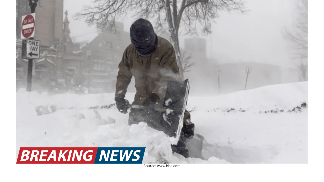
For shoveling, technique matters—especially when snow is wet or packed. Guidance emphasized pushing rather than lifting, bending with the knees, avoiding twisting, and keeping shovel loads light by filling only halfway. Shoveling early and often can prevent snow from becoming heavier and icier. Residents were also reminded to clear around fire hydrants, keeping a 3-foot radius open so emergency crews can access them quickly.
Winter storms can also drive up energy bills as households try to stay warm. Suggested steps to manage costs included maintaining heating systems (such as changing air filters and clearing vents), keeping warm air circulating in the rooms people actually use, and programming thermostats to lower temperatures while sleeping or away and warm up before returning.
Season context: above-average snowfall in major cities
The storm is arriving during a winter that has already been snowier than average in several major metropolitan areas. Boston has recorded more than 40 inches of snowfall so far this season—more than 8 inches above average—and far above last year’s 28.1 inches. New York City has also been above average, with 22.3 inches so far after recording 12.9 inches all of last winter, putting the city on track to roughly double last season’s total.
That context matters because repeated storms can strain snow removal operations and leave large snow piles in place, complicating travel and cleanup when the next major event arrives.
What to watch next
As Winter Storm Hernando continues to intensify offshore and push heavy snow inland, the key concerns remain the same: rapidly deteriorating road conditions, widespread travel disruptions, increasing power outages, and the lingering risk of black ice after the storm. With blizzard warnings covering a long stretch of the East Coast and emergency measures already in place, the most important guidance remains to stay off the roads when possible and prepare for extended impacts into Monday.