
Rain and Mountain Snow Return to the West, Including California
A long dry stretch begins to shift
Across much of the West, the past winter and early spring were notable not for frequent storms, but for what was missing: spring showers and mountain snowfall that typically help build snowpack and replenish water supplies. That lack of moisture left conditions unusually dry in many areas and contributed to an extremely low snowpack in the mountains.
Now, the overall weather pattern has shifted. The change is bringing a more active setup capable of delivering widespread moisture—rain at lower elevations and significant snowfall in the higher terrain. For communities and water managers watching the season slip away without enough storms, the return of precipitation is a meaningful development, even if it does not solve the problem on its own.
This new round of weather is best understood as a step in the right direction rather than a full reset. The West is moving from a period of severe under-delivery to one that at least provides some of the precipitation that had been missing. The question is not whether the region will see moisture—many places will—but how much can realistically be recovered given how far behind the season has been.
What the updated pattern means for the West
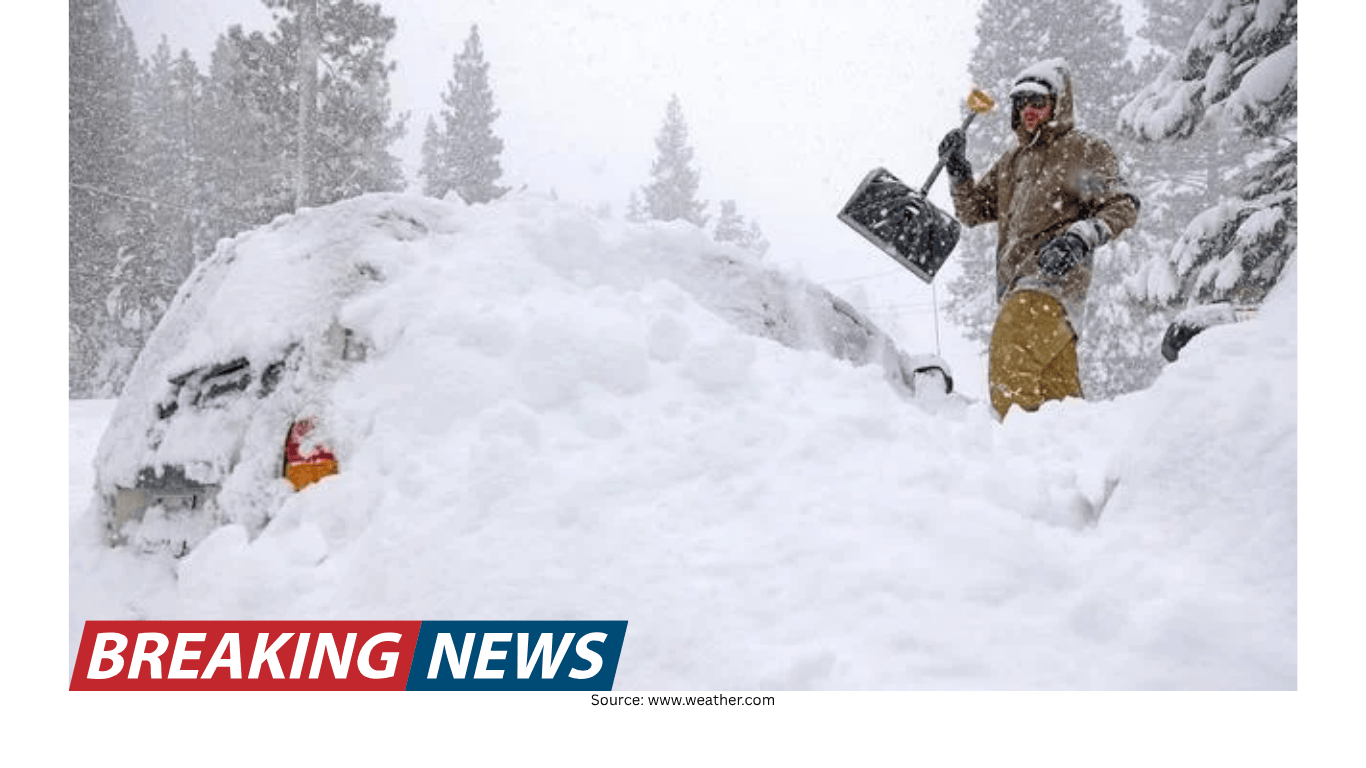
The key change is that storms are once again delivering moisture to a broad range of elevations. In the mountains, that moisture falls as snow, and the forecast calls for mountain snowfall measured in feet. At lower elevations, the same storm system translates into rain, bringing beneficial precipitation to valleys and coastal areas.
This elevation-driven split is typical in western weather. When the atmosphere is cold enough at higher altitudes, storms can deposit snow even while nearby lower terrain receives rain. In this case, that dynamic is especially important because the mountains are where snowpack accumulates—an essential component of the region’s seasonal water storage.
While the return of storms is welcome, it also highlights the scale of the shortfall. Snowpack is described as running extremely low, and even snowfall measured in feet is framed as helping to restore only some of the deficit. That language underscores the reality that a single storm cycle—or even several—may not be enough to fully make up for months of missing precipitation.
California: rain for lower elevations, heavy snow for the mountains
California is among the areas expected to benefit from this wetter pattern. Lower elevations will experience the incoming moisture primarily as rain. In Northern California, rainfall totals of 1 to 2 inches are possible. For many locations, that amount can provide a noticeable boost to soil moisture and short-term water availability.
At the same time, the mountains can expect substantial snowfall. The forecast indicates snowfall measured in feet, which is significant by any standard. Mountain snow is especially valuable because it contributes to snowpack, which can melt gradually and support water supplies later in the year.
However, the outlook remains cautious. Even with heavy mountain snow, the snowpack is still described as extremely low. That means the new snow helps, but it does not erase the broader seasonal deficit. The region may need additional storms beyond this pattern shift to meaningfully rebuild what was lost during the dry winter and early spring.
Why “feet of snow” still may not be enough
Hearing that mountains could receive snowfall measured in feet can sound like a dramatic turnaround. In practical terms, it is a substantial event and can make a visible difference in the high country. Yet the same forecast notes that snowpack is extremely low and that there is still a long way to go.
That apparent contradiction is common in seasons that start with a major precipitation deficit. When a region misses repeated storms over months, the gap becomes large. A single productive storm can narrow the gap, but it often cannot close it entirely. The new snowfall can “restore some of the deficit,” but the remaining shortfall may still be considerable.
The takeaway is that the West is not simply looking for one good storm. The region needs sustained precipitation over time to rebuild snowpack and recover from a season that underperformed. This event is a helpful contribution, but it is not framed as a complete solution.
What residents may notice at different elevations
Because the same storm can produce very different conditions depending on location, impacts and day-to-day experiences will vary across the region.
Lower elevations: Expect moisture primarily as rain, including the potential for 1 to 2 inches in Northern California. Rainfall can be beneficial after a dry period, but it also changes travel conditions and can affect outdoor plans.
Mountain areas: Snowfall measured in feet is expected. That can quickly transform mountain landscapes and may influence access, travel, and recreation in higher terrain.
Transition zones: Areas between valley floors and high peaks often see mixed conditions depending on temperature. Small shifts can determine whether precipitation falls as rain or snow.
Even without focusing on specific hazards, it is clear that this kind of storm pattern brings a more wintry feel back to the mountains while delivering a more classic spring-like rain to lower elevations. For a region that has been short on both spring showers and mountain snowfall, that combination is precisely what has been missing.
Relief, but not a reset
The forecast is careful to describe the shift as “much-needed relief.” That phrase signals improvement without overstating the outcome. Relief suggests that the dryness has been persistent enough to create concern, and that the return of precipitation is meaningful. But it also implies that the underlying situation—especially the low snowpack—remains a challenge.
In other words, this is a positive development within a larger context. The West is receiving storms again, and that matters. Yet the same forecast emphasizes that “there is still a long way to go and much more is needed.” That perspective is important for setting expectations: the region is not instantly back to normal just because a wetter pattern has arrived.
How to interpret the numbers in the forecast
The forecast contains two key quantitative signals: rainfall totals of 1 to 2 inches in Northern California and mountain snowfall measured in feet. Both are substantial, but they represent different types of water input.
Rainfall totals are relatively straightforward: they describe how much liquid precipitation can accumulate over a period. In Northern California, 1 to 2 inches can be a meaningful event, especially after a dry stretch. It can quickly wet soils, replenish small waterways, and provide short-term improvement in moisture conditions.
Snowfall totals measured in feet reflect the depth of snow that may accumulate in the mountains. Snow depth does not translate directly into water content without additional information, but the forecast’s emphasis is clear: the mountains are expected to receive a major dose of snow compared with what has been lacking.
Together, these numbers illustrate a storm that is capable of delivering widespread precipitation. But the forecast also provides the necessary context: the snowpack deficit is large, and even strong storms may only partially restore what is missing.
Why this shift matters after a dry winter and early spring
When winter storms are scarce, the effects can compound. A lack of mountain snowfall reduces snowpack, and a lack of spring showers limits the gradual replenishment of moisture that typically supports landscapes as temperatures rise. The result is a season that feels out of balance: too little rain where it is usually expected, and too little snow where it matters most for long-term water storage.
The return of storms addresses both sides of that equation. Rain at lower elevations helps restore some of the missing spring moisture. Snow in the mountains helps rebuild snowpack. The fact that the forecast highlights both types of precipitation is a reminder that the West’s water story is closely tied to elevation and temperature.
Still, the forecast’s caution is warranted. The region is not described as merely “below average” but as facing an “extremely low” snowpack. That level of deficit is not easily corrected, particularly as the season advances.
What to watch as the pattern evolves
The most important theme in the forecast is not just that precipitation is coming, but that the broader pattern has changed. That implies the potential for additional storms beyond the immediate event, though no specific future totals are provided here.
As this shift unfolds, observers will likely focus on a few broad questions:
How much of the deficit can be restored? The forecast suggests that some recovery is possible, but that the gap remains large.
How consistently does the new pattern deliver? One storm helps, but sustained precipitation is often needed to meaningfully improve seasonal outcomes.
How do conditions vary by elevation? The split between rain in lower elevations and snow in the mountains is central to how beneficial the event is for snowpack.
For now, the immediate message is clear: the West is moving into a wetter period that brings rain to lower elevations and heavy mountain snow, including in California. It is a welcome change after a season that fell short, and it offers a measure of improvement—while also underscoring that more precipitation will still be needed to fully address the unusually low snowpack.