
Easterlies to Trigger Isolated Rains Over Metro Manila and Several Parts of the Philippines
Warm, humid easterlies set the tone for the next 24 hours
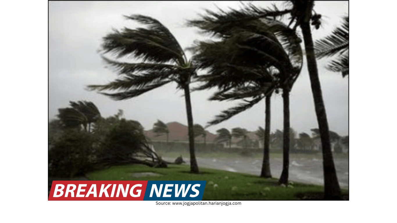
Humid and warm weather associated with the easterlies is expected to shape conditions over Metro Manila and many other parts of the Philippines within the next 24 hours, based on the latest advisory from the country’s state weather agency. The prevailing pattern points to skies ranging from partly cloudy to overcast, with the possibility of isolated rain showers or thunderstorms.
For residents and travelers, the key message is that rainfall is not expected to be continuous everywhere, but brief downpours and thunderstorm activity may develop in localized areas. These conditions can still disrupt commutes, outdoor plans, and short-distance travel—particularly when thunderstorms form and rain falls heavily over a limited area.
The same advisory notes that the easterlies are bringing in warm, moisture-laden air. This setup often supports cloud development, especially later in the day, when heat and humidity combine to fuel isolated showers and thunderstorms.
No low-pressure area observed inside or outside the country’s monitoring zone
In the same weather briefing, a weather specialist said the national weather agency has not spotted any low-pressure area forming either inside or outside the country’s area of responsibility. This detail is significant because low-pressure areas can sometimes become more organized weather disturbances that bring broader and more sustained rainfall.
With no low-pressure area detected at the time of the briefing, the forecast focus remains on the effects of the easterlies and other existing weather systems. While the absence of a developing low-pressure area may reduce the likelihood of widespread, prolonged rains in the immediate period, localized thunderstorms can still produce intense bursts of rain in short windows.
Shear line affecting parts of Northern and Central Luzon
Aside from the easterlies, another weather system is influencing conditions in several provinces: the shear line, described as the convergence of hot and cold air. According to the briefing, this shear line has been affecting Cagayan, Isabela, Aurora, Quezon, and Rizal.
In these areas, the expected weather includes cloudy skies with scattered rain showers and isolated thunderstorms. Compared with the “isolated” rain pattern mentioned for Metro Manila and many other areas, “scattered” rainfall suggests a higher coverage of rain events across affected provinces, though precipitation may still vary by location and time.
The forecast also included a caution for communities in the shear line-affected areas: flash floods or landslides may be possible due to moderate to at times heavy rains. This warning underscores that even without a developing low-pressure area, rain associated with a shear line can be substantial enough to trigger hazards, especially in places vulnerable to flooding or slope instability.
Areas with potential for heavier rain-related impacts
The advisory highlighted the possibility of flash floods or landslides in areas being influenced by the shear line, particularly when rainfall becomes moderate to heavy. While the forecast does not specify exact rainfall totals, it emphasizes that the intensity may at times be enough to create dangerous conditions.
Communities in Cagayan, Isabela, Aurora, Quezon, and Rizal are among those mentioned as being affected by the shear line. In periods of heavier rain, low-lying areas may be more susceptible to sudden flooding, while mountainous or hilly locations may face an elevated risk of landslides.
Because shear line impacts can shift and concentrate in specific locations, conditions may change quickly. Rain may be intermittent, but when it occurs, it can be intense. This is why the advisory’s warning focuses not only on the presence of rain, but also on the potential hazards that can accompany stronger bursts.
Metro Manila and the broader national outlook under easterlies
For Metro Manila, the forecast points to partly cloudy to overcast skies with isolated rain showers or thunderstorms within the next 24 hours. Similar conditions are expected across the rest of the country under the influence of the easterlies, with localized rainfall possible even when much of the day remains warm and humid.
In practical terms, this type of forecast often means that some neighborhoods may experience a brief thunderstorm while nearby areas remain dry. The timing can also vary, with showers developing suddenly and dissipating quickly. Residents may notice a mix of sunshine, cloud build-up, and short-lived rain events rather than an all-day rainy pattern.
Even isolated thunderstorms can bring lightning and gusty winds, and the combination of heat and humidity may persist in between rain episodes. For those planning activities, it may be useful to anticipate changing sky conditions and the possibility of brief rain interruptions.
Western Visayas, Palawan, and parts of the southern Philippines also under wetter skies
Beyond Metro Manila and the shear line-affected provinces, the advisory also pointed to areas where the easterlies may bring more pronounced cloudiness and rainfall. Over Western Visayas, Palawan, Basilan, Sulu, and Tawi-Tawi, the easterlies are expected to produce overcast skies with scattered rains and thunderstorms.
The description of “overcast skies with scattered rains and thunderstorms” suggests a more frequently wet pattern than areas expecting only isolated showers. While rain may not be constant, the coverage and recurrence of showers may be higher across these locations.
For coastal and island communities in these areas, scattered thunderstorms can affect sea and land travel plans, particularly when storms develop quickly. Overcast conditions may also reduce visibility at times during heavier showers.
Northeast monsoon continues over northern Luzon
While the easterlies dominate much of the country’s short-term outlook, the northeast monsoon—locally known as “amihan”—is still prevailing over parts of northern Luzon. The advisory said amihan would affect Ilocos Region, the Cordillera Administrative Region, and the rest of Cagayan Valley.
Under the northeast monsoon, these areas are expected to experience partly cloudy to cloudy skies with isolated light rains. Compared with the shear line’s potential for moderate to heavy rain in certain provinces, the monsoon-related rain mentioned here is characterized as light and isolated.
This means that while northern Luzon may still see some rainfall, it is expected to be generally lighter and less widespread than the scattered rains associated with the shear line or the overcast, thunderstorm-prone conditions forecast for parts of Western Visayas, Palawan, and the far south.
How the different weather systems shape local conditions
The advisory describes three distinct influences operating at the same time: the easterlies, the shear line, and the northeast monsoon. Each one can shape weather differently depending on location.
Easterlies: Warm, humid air that can lead to partly cloudy to overcast skies and isolated rain showers or thunderstorms in many areas, including Metro Manila. In some regions, it may also bring overcast skies with scattered rains and thunderstorms.
Shear line: A convergence of hot and cold air affecting specific provinces such as Cagayan, Isabela, Aurora, Quezon, and Rizal, bringing cloudy skies with scattered rain showers and isolated thunderstorms, with a warning for possible flash floods or landslides due to moderate to heavy rain at times.
Northeast monsoon (amihan): Prevailing over Ilocos Region, the Cordillera Administrative Region, and the rest of Cagayan Valley, bringing partly cloudy to cloudy skies with isolated light rains.
Understanding these distinctions can help explain why one area may be dealing with heavier rain potential while another experiences only brief, light showers. It also clarifies why forecasts can vary significantly across provinces even within the same day.
What “isolated” versus “scattered” rain can mean on the ground
The advisory uses terms that describe how widespread rainfall may be. “Isolated” rain showers or thunderstorms generally indicate that only a few locations will experience rain, and that many places may stay dry. “Scattered” rains suggest that more areas will see rainfall, though not necessarily at the same time.
In Metro Manila, the forecast emphasizes isolated rain showers or thunderstorms, meaning rainfall may be hit-or-miss across the metropolis. In contrast, provinces affected by the shear line and areas such as Western Visayas, Palawan, Basilan, Sulu, and Tawi-Tawi are expected to see scattered rains and thunderstorms, implying a broader distribution of rain events.
These descriptions matter for planning daily routines. Isolated thunderstorms can still be disruptive, especially if they occur during peak travel hours, but scattered rains increase the likelihood that more communities will experience wet conditions at some point in the day.
Risk reminders for communities in shear line-affected provinces
The warning about possible flash floods or landslides is specifically tied to the shear line’s potential to bring moderate to heavy rains at times. The advisory’s emphasis suggests that residents in affected provinces should remain alert for changing conditions, particularly during periods of heavier rain.
Flash flooding can occur quickly during intense downpours, while landslide risks can rise when soils become saturated. The advisory does not specify which municipalities are most at risk, but it identifies the provinces experiencing the shear line’s influence, indicating where vigilance may be most important.
Summary of expected conditions by area
Based on the latest forecast, the following conditions are expected within the next 24 hours:
Metro Manila: Partly cloudy to overcast skies with isolated rain showers or thunderstorms due to the easterlies.
Much of the country: Similar easterly-driven conditions, with warm and humid weather and the chance of isolated rain showers or thunderstorms.
Cagayan, Isabela, Aurora, Quezon, Rizal: Cloudy skies with scattered rain showers and isolated thunderstorms due to the shear line; possible flash floods or landslides during moderate to heavy rain at times.
Western Visayas, Palawan, Basilan, Sulu, Tawi-Tawi: Overcast skies with scattered rains and thunderstorms due to the easterlies.
Ilocos Region, Cordillera Administrative Region, rest of Cagayan Valley: Partly cloudy to cloudy skies with isolated light rains due to the northeast monsoon (amihan).
Looking ahead: monitoring remains focused on existing systems
With no low-pressure area observed forming inside or outside the country’s area of responsibility at the time of the briefing, the immediate outlook centers on the ongoing influence of the easterlies, the shear line, and the northeast monsoon. For many locations, the day-to-day experience may be a familiar mix: warm and humid conditions interrupted by localized showers or thunderstorms.
At the same time, the advisory’s hazard warning for shear line-affected provinces highlights that rainfall intensity can still reach levels that pose risks, even when the overall pattern is not tied to a developing low-pressure area. In areas expecting scattered rains and thunderstorms, periods of heavier rain may occur, and conditions can change quickly.
Across the country, the forecast points to varied weather depending on location—ranging from isolated light rains in parts of northern Luzon under amihan, to scattered thunderstorms in provinces influenced by the shear line and the easterlies. The common thread is the potential for rain events that may be localized but occasionally intense.