
Travel Weather Outlook: Tracking Storm Delays in the East and Warmth in the West
A travel forecast designed for the next few days
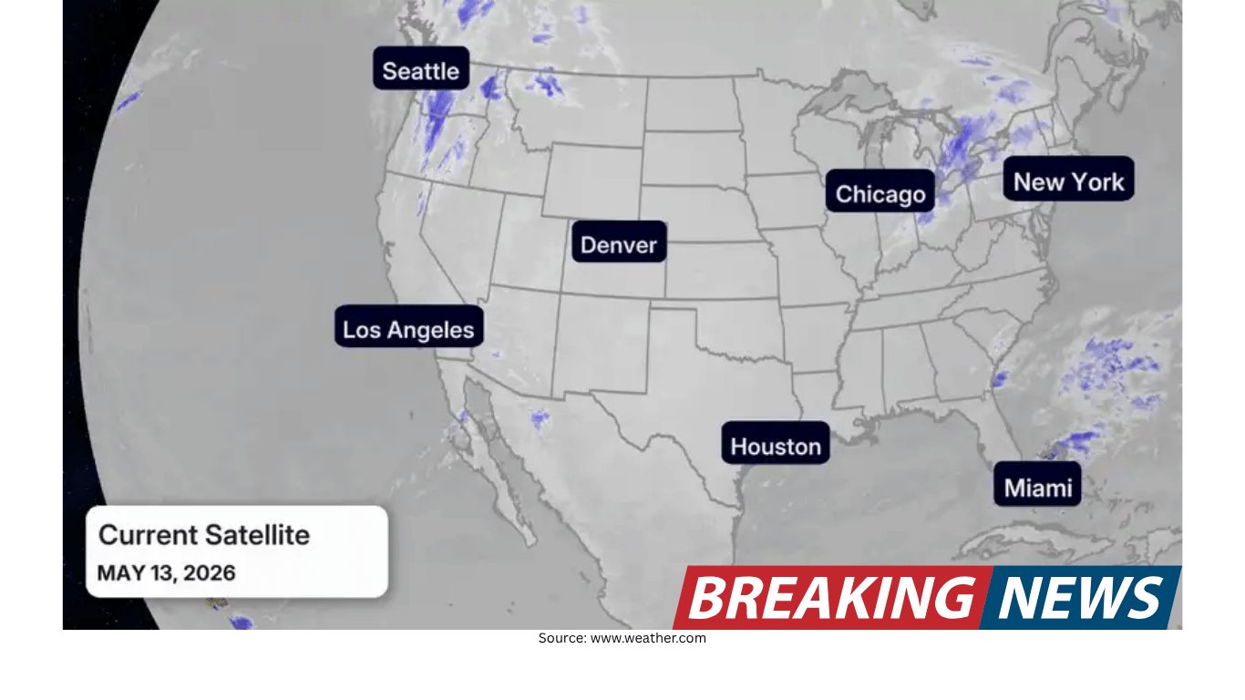
If you’re traveling in the next few days, the main theme is a split pattern: weather-related travel delays are most likely across the eastern half of the country, while record warmth dominates the West. That doesn’t mean every trip will be disrupted, but it does mean travelers should plan with extra time and keep an eye on changing conditions, particularly around major airport hubs and heavily traveled road corridors.
This outlook focuses on the specific areas where rain, thunderstorms, and lingering showers could affect schedules. It also highlights two additional factors that can shape how a trip feels and how smoothly it goes: jet stream headwinds that influence flight times and seasonal pollen that may affect outdoor plans.
Eastern U.S.: A cold front brings rain and storms Wednesday into Wednesday night
The most notable travel concern is tied to a low pressure system and its cold front shifting east on Wednesday. As this system moves, it is expected to bring rain and storms from New England to the Carolinas by Wednesday night. For travelers, this kind of setup can create a chain reaction of delays—especially during peak evening travel windows—because thunderstorms and heavier rain can slow airport operations and complicate road travel.
If your itinerary includes the Northeast on Wednesday night, it’s worth preparing for potential disruptions. Major hubs in the region, including New York and Washington, D.C., could see weather-related delays during that period. Even when storms are not severe, periods of rain and embedded thunderstorms can reduce visibility and require operational adjustments that ripple into departure and arrival times.
Northeast: Showers linger into Thursday and Friday
The midweek system does not simply clear out overnight. Showers are expected to remain for the Northeast on Thursday and Friday. Lingering precipitation can be less dramatic than a line of storms, but it can still be disruptive in practical ways: occasional flight delays, slower airport ground operations, and wet commutes for travelers navigating cities by car, rideshare, or public transit.
For anyone moving through the Northeast later in the week, the best strategy is to anticipate variability. A showery pattern can produce on-and-off rain that makes timing more difficult. It may be dry for a stretch and then turn wet again, which matters for everything from airport transfers to outdoor plans.
Florida: Continued showers and storms through Wednesday
Florida remains another area to watch in the near term. Showers and storms are expected to continue through Wednesday. For travelers, this can translate to minor airport delays in a few locations, along with heavy downpours that affect road travel.
Even brief downpours can quickly change driving conditions. Vacationers and commuters alike may encounter reduced visibility and water on roadways during heavier bursts of rain. If your travel plans involve driving to or from an airport, heading to a hotel, or moving between destinations, it’s wise to build in extra time and be prepared for sudden changes in conditions.
Pacific Northwest: Scattered showers lasting through the week
While the biggest travel-delay concerns are focused in the East, the Pacific Northwest has its own persistent feature: scattered showers are expected to impact the region through the week. A showery pattern does not always cause major disruptions, but it can influence outdoor activities and create periodic slick roads, especially during commutes or longer drives.
Travelers in the Pacific Northwest should consider keeping rain gear accessible and planning for intermittent wet conditions rather than a single, well-defined period of rain.
West: Record warmth dominates
In contrast to the storm and shower pattern affecting parts of the East, record warmth is dominating the West. For travelers, warmth can be welcome, but it can also change how you plan day-to-day activities. A warmer-than-usual pattern may influence what you pack and how you schedule time outdoors.
This west-versus-east contrast is important for multi-city trips. If you’re traveling across regions, you may be moving between very different conditions in a short span—another reason to check forecasts for each stop rather than relying on a single general outlook.
Air travel note: The jet stream can speed up or slow down flights
Beyond storms and showers, flight times themselves can be influenced by the jet stream. In general, flyers travel faster eastward with the jet stream and slower flying westward against strong headwinds within the jet stream. This is a useful reminder for travelers comparing flight durations in different directions or wondering why a westbound trip sometimes takes longer than an eastbound one.
In jet stream maps, the faster-moving air is often shown as ribbons shaded in purples, pinks, and whites. While the jet stream does not automatically mean turbulence or delays, it does help explain why travel time can vary and why airlines may adjust routing and timing.
Health and comfort: Pollen can affect outdoor plans
Travel planning isn’t only about rain and flight schedules. Seasonal factors can also shape the experience of a trip. Trees and grasses are in full swing in many areas, which means pollen can be a meaningful consideration for anyone sensitive to it.
Pollen sufferers may want to account for this in outdoor plans, especially if a trip includes extended time outside—walking tours, parks, outdoor dining, or recreational activities. Even when the weather is otherwise cooperative, high pollen can affect comfort and energy, so it’s worth factoring into the daily plan.
Practical planning: Where delays are most likely and how to prepare
Weather-related delays are never guaranteed, but the pattern described here points to a few higher-risk windows and places. The Wednesday-to-Friday period is most notable for the East, with the Wednesday night timeframe standing out for the Northeast corridor and nearby travel hubs. Florida’s continued storms through Wednesday can also create localized slowdowns. Meanwhile, the Pacific Northwest should expect a weeklong backdrop of scattered showers.
To translate that into practical steps, consider these planning ideas based on the forecast themes:
Build in extra time for connections in the East. With rain and storms from New England to the Carolinas by Wednesday night, airport operations may slow, particularly around major hubs.
Expect lingering wet conditions in the Northeast Thursday and Friday. Even if thunderstorms are not constant, showers can still trigger occasional flight delays and create wet commutes.
In Florida, plan around downpours. Continued showers and storms through Wednesday may lead to minor airport delays and heavy rain for road travelers.
In the Pacific Northwest, prepare for intermittent rain. Scattered showers lasting through the week can affect day trips and outdoor plans.
For cross-country travel, pack for contrast. Record warmth in the West alongside wetter, stormier conditions in parts of the East can make a single packing list tricky.
Remember the jet stream’s role in flight duration. Eastbound flights often benefit from faster winds, while westbound flights may face headwinds and longer travel times.
Account for pollen if you’re sensitive. With trees and grasses active in many areas, outdoor time may feel different than expected even when skies are clear.
A region-by-region snapshot
For travelers who prefer a quick scan, here is a simplified regional summary grounded in the current forecast themes:
New England to the Carolinas: Rain and storms expand eastward on Wednesday, reaching this corridor by Wednesday night.
Northeast (including major hubs): Potential for weather-related delays Wednesday night, with showers continuing Thursday and Friday and the possibility of occasional flight delays and wet commutes.
Florida: Showers and storms continue through Wednesday, with the potential for minor airport delays and heavy downpours affecting road travel.
Pacific Northwest: Scattered showers persist through the week.
West overall: Record warmth dominates.
Using maps and short-term forecasts to stay ahead
When weather is active in travel corridors, maps and short-term forecast updates can be especially helpful. A large-scale forecast can tell you which regions are most likely to see storms or showers, but conditions that cause delays—like timing of heavier rain or thunderstorm clusters—often shift over hours rather than days.
That’s why it can be useful to check conditions before heading to the airport, before starting a long drive, and again during key decision points such as leaving for a connection or choosing a departure time. Even in a generally wet pattern, there may be windows of lighter precipitation that make travel easier.
Bottom line
The next few days feature a familiar spring travel challenge: storms and showers in portions of the East, including a midweek push of rain and storms from New England to the Carolinas by Wednesday night and lingering showers in the Northeast into Thursday and Friday. Florida continues to deal with showers and storms through Wednesday, while the Pacific Northwest stays in a pattern of scattered showers through the week. At the same time, record warmth dominates the West.
For travelers, the takeaway is simple: plan for possible delays in the East, keep an eye on timing around major hubs, and remember that the jet stream can affect flight duration. And if your trip includes time outdoors, don’t overlook pollen as a factor that can shape comfort and daily plans.